![](/images/other/stat-length.png)
![Trail On foot East Hampshire - Long Woodland Trail - Photo](https://media.geolcdn.com/t/1900/400/fa61a4cc-8a99-4175-b627-a3051fdf68f3.jpeg&format=pjpeg&maxdim=2)
Long Woodland Trail
SityTrail - itinéraires balisés pédestres
Tous les sentiers balisés d’Europe GUIDE+
![Length](/images/other/stat-length.png)
Length
7.8 km
![Max alt](https://static1.geolcdn.com/siteimages/upload/files/1508320355ic_sort_altitude_max_24dp.png)
Max alt
248 m
![Uphill gradient](https://static1.geolcdn.com/siteimages/upload/files/1508320355ic_sort_den_pos_24dp.png)
Uphill gradient
190 m
![Km-Effort](/images/other/stat-length.png)
Km-Effort
10.3 km
![Min alt](https://static1.geolcdn.com/siteimages/upload/files/1508320355ic_sort_altitude_min_24dp.png)
Min alt
114 m
![Downhill gradient](https://static1.geolcdn.com/siteimages/upload/files/1508320355ic_sort_den_neg_24dp.png)
Downhill gradient
184 m
![Boucle](https://static1.geolcdn.com/siteimages/upload/files/16400158638029165_repeat_loop_refresh_sync_direction_icon.png)
Boucle
Yes
Signpost
Creation date :
2025-02-05 09:44:40.617
Updated on :
2025-02-05 09:44:40.617
![On foot](https://static1.geolcdn.com/sitytour/trail-icons/100.png)
2h20
Difficulty : Easy
![Scan this QR Code to open this trail in the SityTrail application](https://capi.geolives.com/qq0zvz2zws4bq2lad0pu/sitytour/trails/4341065/qr.png?size=200)
FREE GPS app for hiking
About
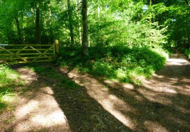
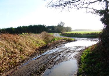
Trail On foot of 7.8 km to be discovered at England, Hampshire, East Hampshire. This trail is proposed by SityTrail - itinéraires balisés pédestres.
Description
Trail created by Queen Elizabeth Country Park.
marked with signs showing a red shoe in a green square
Symbol: purple footprint in green square
Positioning
Country:
United Kingdom
Region :
England
Department/Province :
Hampshire
Municipality :
East Hampshire
Location:
Unknown
Start:(Dec)
Start:(UTM)
641998 ; 5647497 (30U) N.
Comments
Trails nearby
![Trail Bicycle tourism - Portsmouth/ swanage - Photo](https://media.geolcdn.com/t/375/260/ext.jpg?maxdim=2&url=https%3A%2F%2Fstatic1.geolcdn.com%2Fsiteimages%2Fupload%2Ffiles%2F1524743154velo.jpg)
![Bicycle tourism Bicycle tourism](https://static1.geolcdn.com/sitytour/trail-icons/204.png)
Portsmouth/ swanage
Bicycle tourism
Very difficult
,
England,
Portsmouth,
United Kingdom
![](/images/other/stat-length.png)
115 km | 127 km-effort
7h 38min
![](https://static1.geolcdn.com/siteimages/upload/files/16400158638029165_repeat_loop_refresh_sync_direction_icon.png)
No
![Trail Walking Chichester - Chichester canal 230313 - Photo](https://media.geolcdn.com/t/375/260/ext.jpg?maxdim=2&url=https%3A%2F%2Fstatic1.geolcdn.com%2Fsiteimages%2Fupload%2Ffiles%2F1553511878bg_sport_marche.png)
![Walking Walking](https://static1.geolcdn.com/sitytour/trail-icons/101.png)
Chichester canal 230313
Walking
Easy
Chichester,
England,
West Sussex,
United Kingdom
![](/images/other/stat-length.png)
7.2 km | 7.5 km-effort
3h 14min
![](https://static1.geolcdn.com/siteimages/upload/files/16400158638029165_repeat_loop_refresh_sync_direction_icon.png)
No
![Trail Walking Chichester - Chichester Walls 230409 - Photo](https://media.geolcdn.com/t/375/260/ext.jpg?maxdim=2&url=https%3A%2F%2Fstatic1.geolcdn.com%2Fsiteimages%2Fupload%2Ffiles%2F1553511878bg_sport_marche.png)
![Walking Walking](https://static1.geolcdn.com/sitytour/trail-icons/101.png)
Chichester Walls 230409
Walking
Easy
Chichester,
England,
West Sussex,
United Kingdom
![](/images/other/stat-length.png)
3.2 km | 3.4 km-effort
1h 53min
![](https://static1.geolcdn.com/siteimages/upload/files/16400158638029165_repeat_loop_refresh_sync_direction_icon.png)
Yes
![Trail Walking Chichester - Chichester pm 230408 - Photo](https://media.geolcdn.com/t/375/260/ext.jpg?maxdim=2&url=https%3A%2F%2Fstatic1.geolcdn.com%2Fsiteimages%2Fupload%2Ffiles%2F1553511878bg_sport_marche.png)
![Walking Walking](https://static1.geolcdn.com/sitytour/trail-icons/101.png)
Chichester pm 230408
Walking
Easy
Chichester,
England,
West Sussex,
United Kingdom
![](/images/other/stat-length.png)
4 km | 4.3 km-effort
3h 36min
![](https://static1.geolcdn.com/siteimages/upload/files/16400158638029165_repeat_loop_refresh_sync_direction_icon.png)
Yes
![Trail Walking Chichester - Chichester 230408 - Photo](https://media.geolcdn.com/t/375/260/ext.jpg?maxdim=2&url=https%3A%2F%2Fstatic1.geolcdn.com%2Fsiteimages%2Fupload%2Ffiles%2F1553511878bg_sport_marche.png)
![Walking Walking](https://static1.geolcdn.com/sitytour/trail-icons/101.png)
Chichester 230408
Walking
Easy
Chichester,
England,
West Sussex,
United Kingdom
![](/images/other/stat-length.png)
2.8 km | 2.9 km-effort
39min
![](https://static1.geolcdn.com/siteimages/upload/files/16400158638029165_repeat_loop_refresh_sync_direction_icon.png)
Yes
![Trail On foot - Langstone Harbour Waterside Route - Photo](https://media.geolcdn.com/t/375/260/31f43d73-2523-431a-bed1-4553f9f2ab3b.jpeg&format=jpg&maxdim=2)
![On foot On foot](https://static1.geolcdn.com/sitytour/trail-icons/100.png)
Langstone Harbour Waterside Route
On foot
Medium
,
England,
Portsmouth,
United Kingdom
![](/images/other/stat-length.png)
23 km | 24 km-effort
5h 32min
![](https://static1.geolcdn.com/siteimages/upload/files/16400158638029165_repeat_loop_refresh_sync_direction_icon.png)
Yes
![Trail On foot Winchester - Dutton Estate walk - Photo](https://media.geolcdn.com/t/375/260/7b019ca0-c7fb-42c9-a63c-a5303600b5e6.jpeg&format=jpg&maxdim=2)
![On foot On foot](https://static1.geolcdn.com/sitytour/trail-icons/100.png)
Dutton Estate walk
On foot
Easy
Winchester,
England,
Hampshire,
United Kingdom
![](/images/other/stat-length.png)
6.2 km | 7.8 km-effort
1h 45min
![](https://static1.geolcdn.com/siteimages/upload/files/16400158638029165_repeat_loop_refresh_sync_direction_icon.png)
Yes
![Trail On foot Winchester - Soberton and Newtown Millennium Walk - Photo](https://media.geolcdn.com/t/375/260/5bf46148-0d8f-4183-a53b-bf97c876a283.jpeg&format=jpg&maxdim=2)
![On foot On foot](https://static1.geolcdn.com/sitytour/trail-icons/100.png)
Soberton and Newtown Millennium Walk
On foot
Easy
Winchester,
England,
Hampshire,
United Kingdom
![](/images/other/stat-length.png)
16 km | 18.7 km-effort
4h 14min
![](https://static1.geolcdn.com/siteimages/upload/files/16400158638029165_repeat_loop_refresh_sync_direction_icon.png)
Yes